I’ve spent the better part of a decade chasing sunrises over the Marin Headlands and losing myself in the eucalyptus-scented mist of the city's hidden canyons. People think of San Francisco, and they see cable cars and tech campuses. I see a gateway to some of the most diverse terrain on the planet. Within a 30-minute drive of downtown, you can find yourself standing beneath 600-year-old giants, tracking Tule elk along a jagged peninsula, or climbing a wooden ladder through a fern-drenched ravine.
Whether you are looking for the best redwood hikes near San Francisco—like the remote Reinhardt Redwood Regional Park in Oakland or the world-famous Muir Woods National Monument—or you want a rugged coastal trek, the Bay Area delivers. This isn't just a guide; it’s my personal shortlist of the trails that never get old.
Quick Comparison: The Top 8 Trails
| Trail Name | Difficulty | Distance (Round Trip) | Primary Highlight |
|---|---|---|---|
| Lands End | Moderate | 4.5 Miles | Golden Gate Views & Sutro Baths |
| Muir Woods | Easy/Moderate | 2-3 Miles | Old-growth Coastal Redwoods |
| Mount Tamalpais | Moderate/Hard | 6.4 Miles | Steep Ravine Ladder & Ocean Views |
| Tomales Point | Moderate | 9.7 Miles | Wildlife (Tule Elk) & Wild Bluffs |
| Angel Island | Moderate | 5.9 Miles | 360-Degree Panoramic Bay Views |
| Mount Sutro | Moderate | 2.5 Miles | Foggy Eucalyptus Forest in SF |
| Reinhardt Redwood | Moderate | 4-6 Miles | Silent, Remote Redwood Canyons |
| Mission Peak | Hard | 6.0 Miles | Summit Photo-op & Fitness Test |
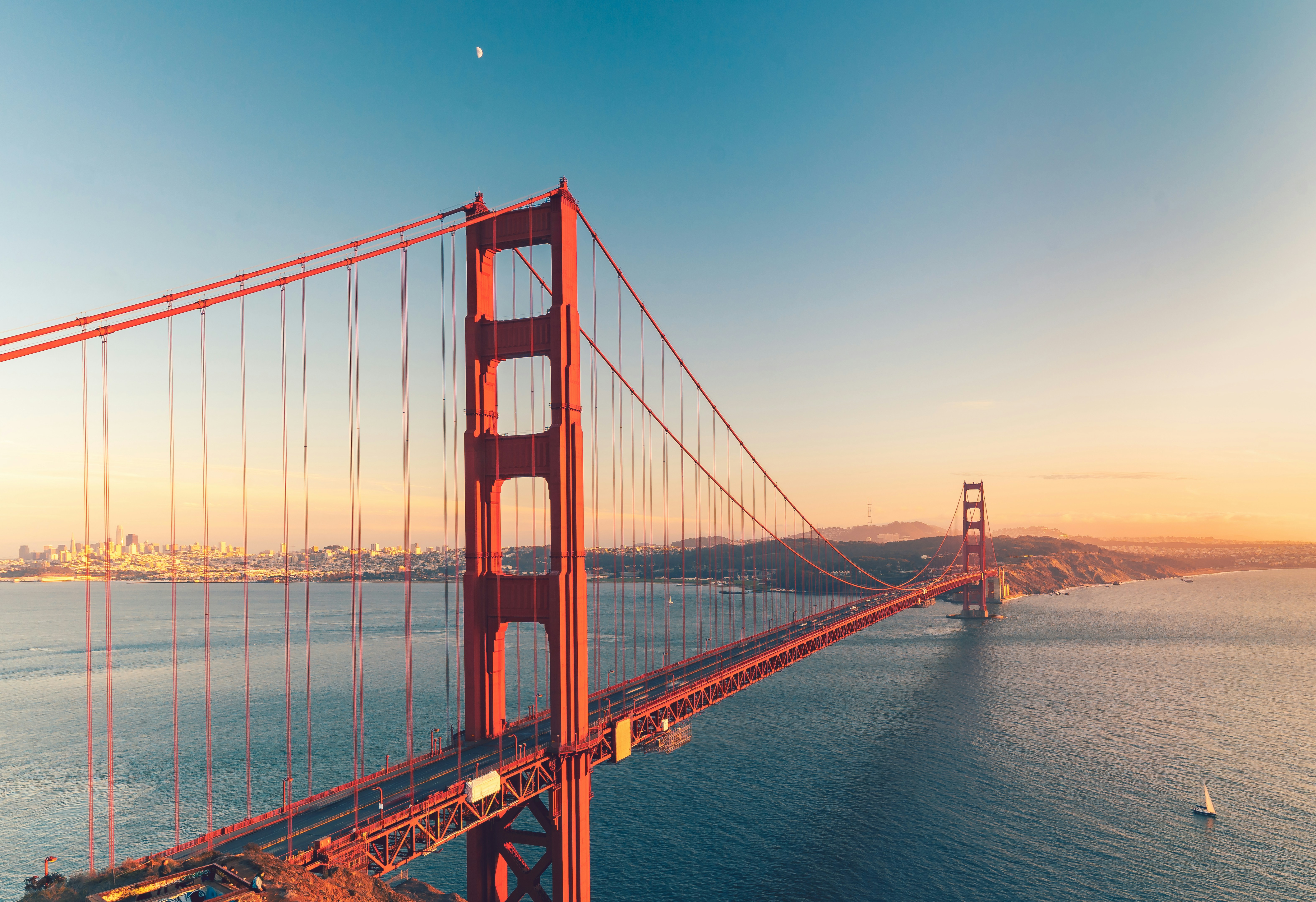
1. Lands End: The Ultimate City Escape
If you only have time for one hike within the city limits, this is it. Lands End hugs the northwest corner of San Francisco, offering a rugged, wind-swept experience that feels worlds away from the Financial District.
The trail starts near the historic Cliff House and winds through cypress-lined paths that frame the Golden Gate Bridge in a way no postcard ever could. For the best views, take the detour down to Eagle’s Point. It’s the highest point on the trail and provides a perspective of the Marin Headlands that will make you stop in your tracks.
I always tell people to keep an eye out for the "hidden" Labyrinth at Eagle’s Point. It’s a stone maze perched on a cliff’s edge, built by a local artist. It’s been destroyed and rebuilt dozens of times—a testament to the city’s resilient spirit.
Key Stats:
- Distance: 4.5 miles out and back
- Elevation: 600 ft gain
- Dog Friendly: Yes (on leash)
Local’s Tip: Don’t skip the ruins of the Sutro Baths at the trailhead. Once the world's largest indoor swimming pool complex, the concrete skeletons now provide a dramatic backdrop for the crashing Pacific waves.
Bonus Mission: After your hike, head over to the Richmond District for an Irish coffee at The Buena Vista. It’s a local rite of passage.
2. Muir Woods National Monument: Walking Among Giants
There’s a reason Muir Woods is the world's most-visited destination for coastal redwoods. Standing in Cathedral Grove, surrounded by trees that predate the Magna Carta, is a humbling experience. The air here is different—cooler, damp, and heavy with the scent of ancient earth.
Most tourists stick to the paved boardwalks in the valley floor, hitting the highlights like Bohemian Grove. If you want to escape the crowds, I suggest taking the Dipsea Trail or the Canopy View Trail. These loops get you above the canopy, where the light filters through the needles in spectacular "god rays."
Key Stats:
- Distance: 1-6 miles (multiple loop options)
- Difficulty: Easy to Moderate
- Best Time: Mid-week, early morning
Logistics Alert: This is the only trail on this list that requires advanced planning. You must reserve your parking spot or shuttle seat weeks in advance via GoMuirWoods.com. There is absolutely no cell service in the park, so download your maps before you leave the city.
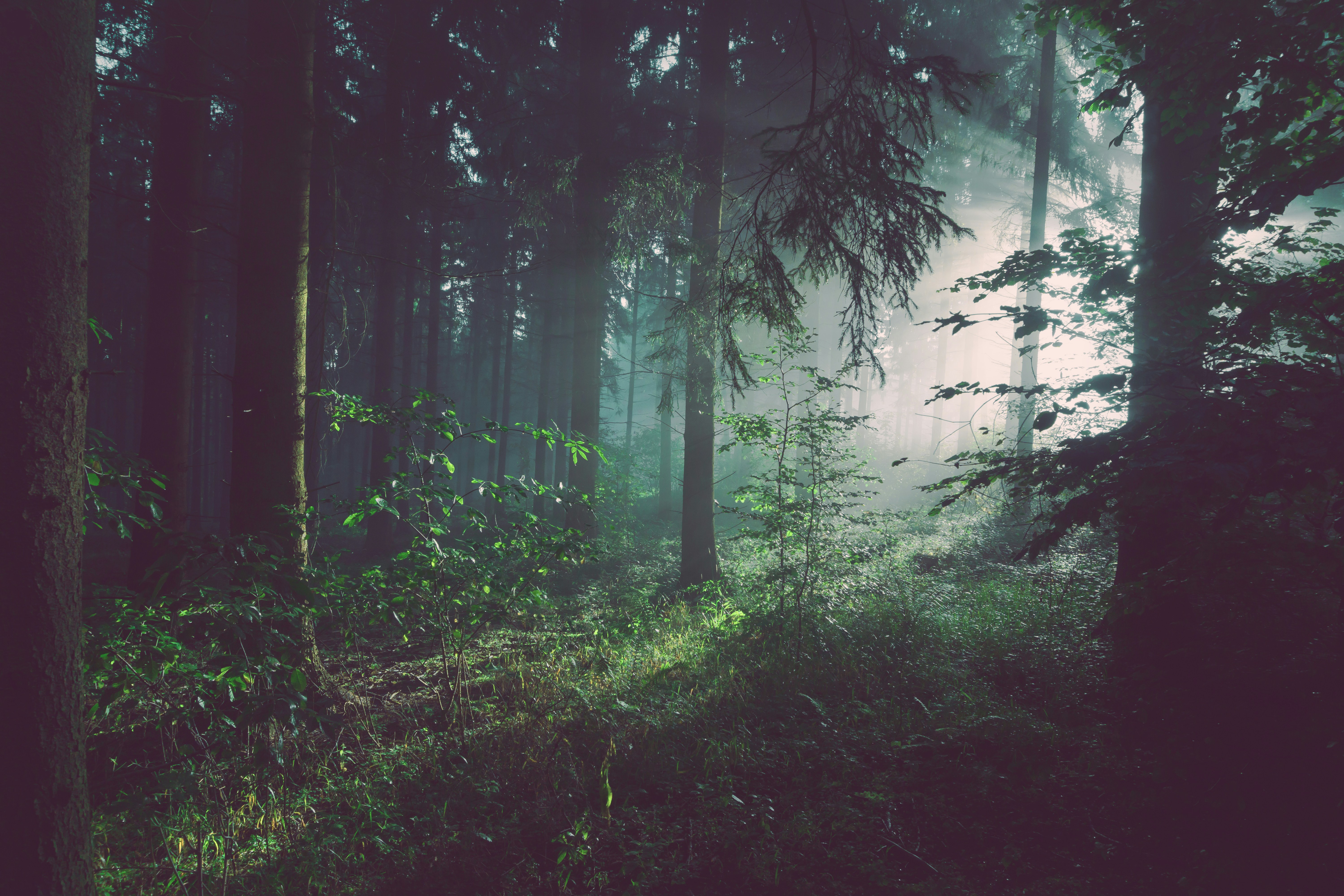
3. Mount Tamalpais State Park: The Peak of Marin
Mount Tamalpais is the crown jewel of Marin County. It offers a massive network of over 200 miles of diverse trails connecting inland redwood groves directly to the Pacific Ocean. If you’re looking for variety, this is your playground.
My go-to route is the Matt Davis-Steep Ravine Loop. You start high at Pantoll Station, descend through rolling grasslands with massive ocean views, and then enter a deep, shaded canyon. The highlight? The famous wooden ladder on the Steep Ravine trail. You’ll climb alongside a rushing creek through a tunnel of ferns and redwoods.
Key Stats:
- Distance: 6.4 miles
- Elevation: 1,600 ft gain
- Terrain: Coastal scrub, redwood canyon, grassy ridges
Bonus Mission: Drive down to Stinson Beach after your hike and grab a bucket of fresh oysters at Parkside Cafe. It’s the ultimate post-trail reward.
4. Tomales Point Trail: Wildlife and Wild Cliffs
For those who want a true wilderness feel, head north to Point Reyes National Seashore. The Tomales Point Trail is a premier spot for viewing native Tule elk, coyotes, and migrating whales. It’s a narrow finger of land with the Pacific Ocean on one side and Tomales Bay on the other.
As you hike toward the tip of the peninsula, the trail becomes more rugged and the wind picks up. Between January and April, keep your eyes on the horizon—you’ll likely see the spouts of migrating gray whales. The Tule elk are everywhere; they are majestic, but remember to keep your distance. These are wild animals, not photo props.
Key Stats:
- Distance: 9.7 miles out and back
- Elevation: 1,170 ft gain
- Wildlife: Tule elk, Northern harriers, gray whales (seasonal)
5. Angel Island State Park: 360 Degrees of Blue
If you want the absolute best view of the entire Bay Area, you have to get on a boat. The North Ridge Trail on Angel Island reaches a 788-foot summit (Mount Livermore), providing the only 360-degree panoramic view of the entire San Francisco Bay Area accessible by ferry.
You’ll see the San Francisco skyline, the Golden Gate Bridge, the Bay Bridge, and Mount Diablo all at once. The island also holds deep history, serving as the "Ellis Island of the West." I highly recommend taking the 6-mile Perimeter Loop if you want a flatter, more historical walk that passes by the old US Immigration Station.
Key Stats:
- Distance: 5.9 miles (North Ridge) or 6 miles (Perimeter)
- Transport: Accessible only by ferry from SF (Embarcadero) or Tiburon.
- Vibe: Island adventure with zero cars.
Local’s Tip: Pack a picnic! There are several tables at the summit of Mount Livermore. Eating your lunch while looking down at the city from 700 feet up is an experience you won't forget.
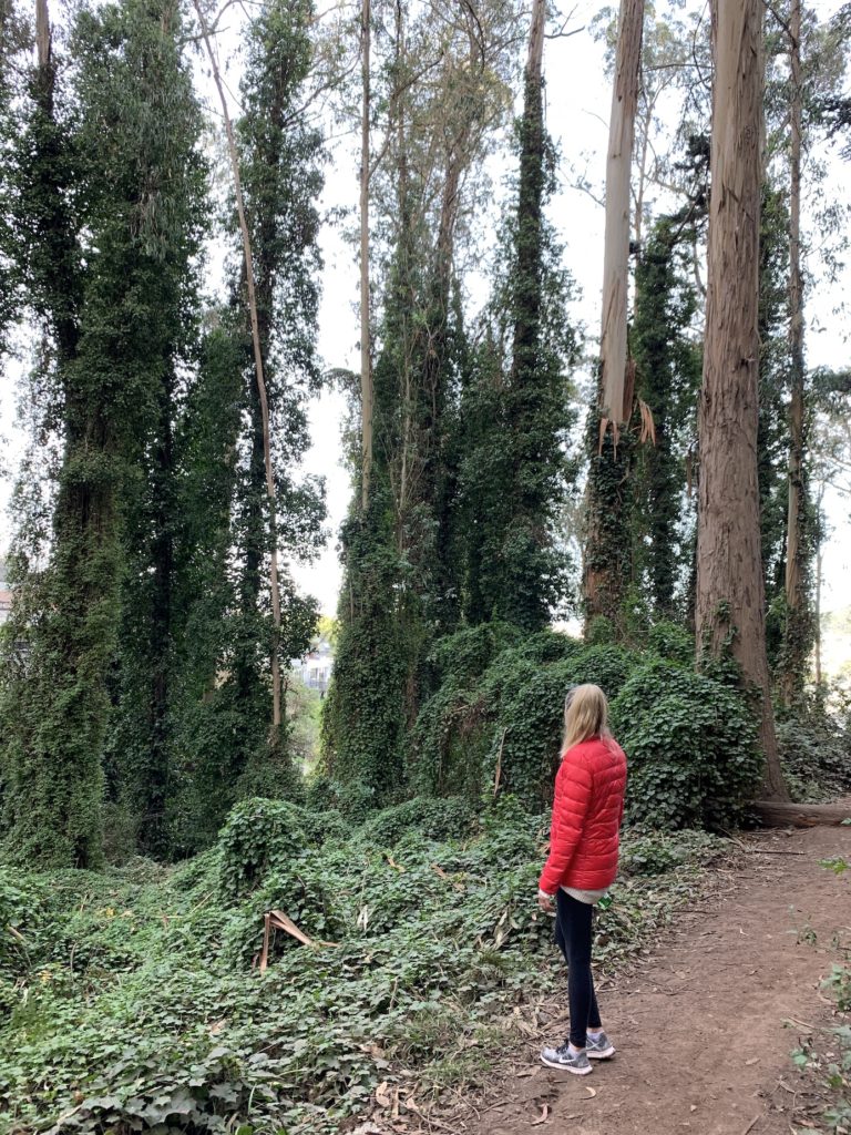
6. Mount Sutro Open Space Reserve: The Foggy Forest
Tucked behind the UCSF Medical Center is a place locals call the "Foggy Forest." Mount Sutro is a 100-year-old eucalyptus forest in the heart of the city (Cole Valley/Inner Sunset). When "Karl the Fog" rolls in, this place transforms into a scene from a fairytale.
The trails are narrow and winding, often shrouded in a thick mist that dampens the sound of the city. You’ll find Monterey pines and massive eucalyptus trees draped in ivy. It’s the perfect spot for a quick morning hike when you need to clear your head but don't want to leave town.
Key Stats:
- Distance: 2-3 mile loops
- Access: Start at the Stanyan Trailhead or near the UCSF Aldea Center.
- Atmosphere: Moody, lush, and quiet.
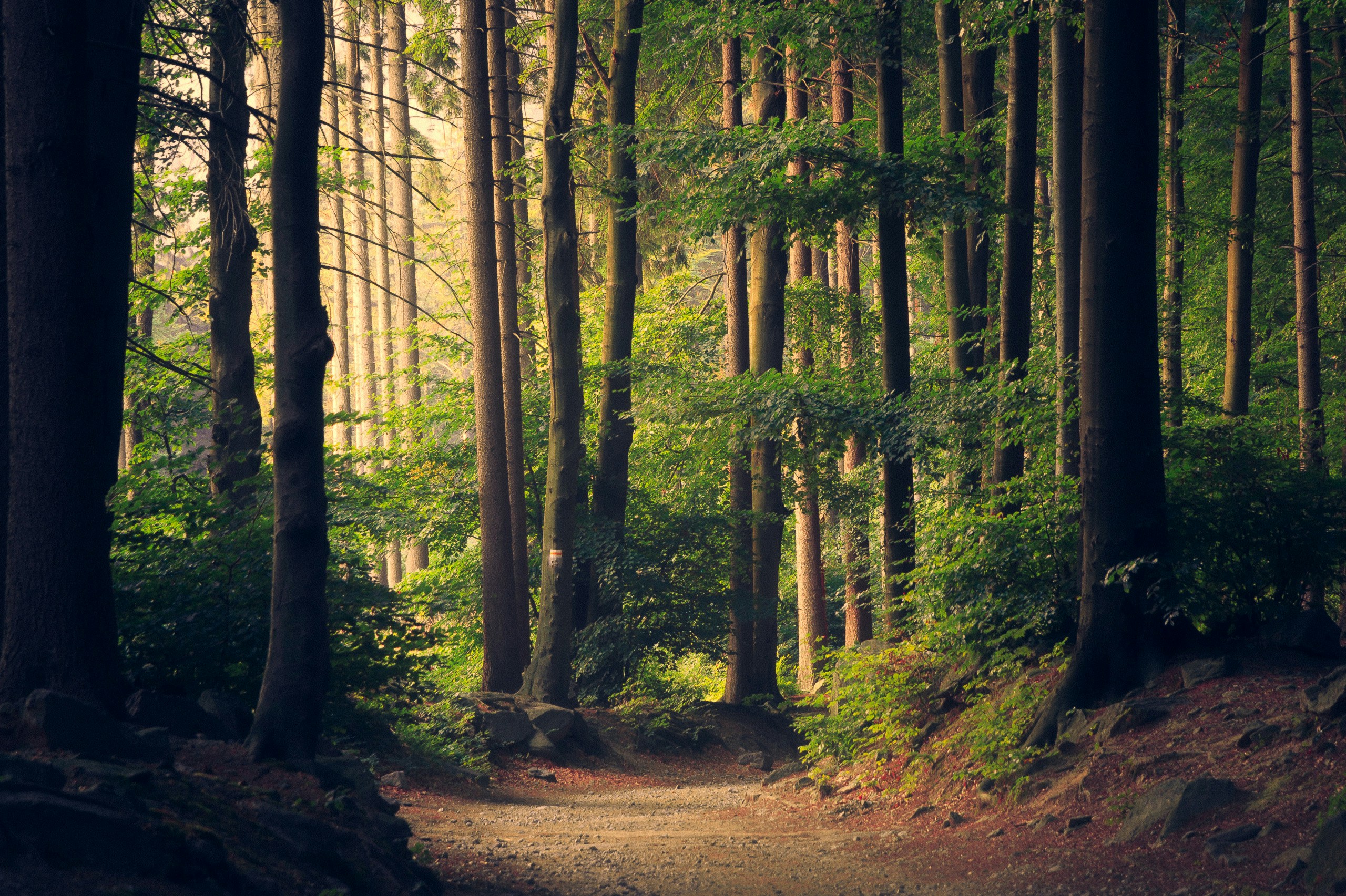
7. Reinhardt Redwood Regional Park: Oakland’s Silent Canyon
If Muir Woods is too crowded for your taste, cross the Bay Bridge to Oakland. Reinhardt Redwood Regional Park offers a remote forest escape just miles from downtown. This 1,833-acre park is home to a hidden forest of second-growth coast redwoods.
For a challenge, take the French Trail. It’s rugged, steep, and snakes through the densest part of the forest. If you prefer something leisurely, the Stream Trail is a flat, paved/gravel path that follows the creek at the bottom of the canyon. This is where I go when I need to disappear into the trees for a few hours without seeing a soul.
Key Stats:
- Distance: Variable (4-8 miles for most loops)
- Difficulty: Moderate to Hard
- Crowd Factor: Low (especially on weekdays)
8. Mission Peak: The Local Fitness Rite of Passage
In the East Bay, hiking Mission Peak is a badge of honor. It’s a 6-mile loop with over 2,100 feet of elevation gain. There is almost zero shade, so this is a "crack of dawn" kind of hike.
The goal for everyone is the "Mission Peeker" pole at the summit. On a clear day, you can see the entire South Bay, Mount Diablo, and even the snow-capped Sierra Nevada mountains in the distance. It’s a grueling climb, but the community vibe at the top is infectious.
Key Stats:
- Distance: 6 miles
- Elevation: 2,152 ft gain
- Warning: High sun exposure. Bring twice as much water as you think you need.
Logistics: Essential Tips for SF Hikers
Microclimates and 'Karl the Fog'
The Bay Area is famous for its microclimates. You can be sweating in the sun on Mission Peak and shivering in the mist at Lands End thirty minutes later. We call the fog "Karl," and he is a constant companion. Always dress in layers. A base layer, a fleece, and a light windbreaker are the standard Bay Area hiking "uniform."
Trail Etiquette and Dogs
San Francisco is a dog-friendly city, but parks have strict rules.
- State Parks (like Mt. Tam and Tomales Point): Generally no dogs on trails.
- Regional Parks (EBRPD): Dogs are often allowed off-leash in designated open spaces.
- National Monuments (Muir Woods): No dogs allowed.
Getting Around
If you don't have a car, don't sweat it. You can take the ferry to Angel Island or Sausalito (to access the Marin Headlands). Rideshares are also common for getting to the Lands End or Mount Sutro trailheads. For Muir Woods, remember that the shuttle is your best friend.
FAQ
When is the best time to see wildflowers? Mid-March through May is peak wildflower season. Head to the Marin Headlands or Mount Tamalpais for poppies and lupine.
Which trails are best for families? Muir Woods is great for its flat boardwalks. Lands End is also excellent because it offers plenty of "escape hatches" if the kids get tired.
Are there any free redwood hikes? Yes! While Muir Woods has an entrance fee, Reinhardt Redwood Regional Park in Oakland is free to enter, though there may be a small parking fee on weekends and holidays.
The Bay Area isn't just a place to live; it's a place to explore. These trails have shaped my perspective on what "urban living" can be. So, grab your boots, check the ferry schedule, and get out there. The redwoods are waiting.